
Now halfway through it’s 9-year funding life, the NASA Arctic Boreal Variability Experiment (ABoVE) is connecting some high-level science findings with practical applications for a variety of stakeholders. The 6th ABoVE Science Team meeting held virtually June 1-4 highlighted a number of these and happily, recorded them for you as well. The interactive posters are well done and a quick read–look for a subject of interest to select a group of interest (e.g. “Fire” returned 9 posters). Not surprisingly, much ABoVE research is focused on big-picture questions like– Can we see trends in vegetation composition, disturbance (like fire and insects), release of greenhouse gases into the atmosphere, and regional weather conditions across the North American boreal region? Specifically, ABoVE is harnessing 30+ years of earth satellite observations, big data management, and brand new remote sensing platforms to answer these questions.
Notably, in this year’s meeting we are seeing the APPLICATION of the science directly with stakeholder groups in Alaska and Canada on very specific management questions. For example:
- Helping Alaska wildlife biologists determine if snow conditions are suitable for conducting the winter moose counts without wasting lots of airplane hours and fuel (Boelman)
- Assisting management of the Tanana Valley State Forest by providing detailed stocking and biomass information from remote sensing and modeling the effect of management (harvest) into the future for planning (Lutz)
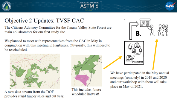
This project is using remotely sensed forest biomass and canopy height to help harvest plans for forest lands around Fairbanks is a great example of practical applications. (slide: David Lutz)
- Correlating human health outcomes in Alaska with remotely-sensed smoke conditions (Loboda)
- Mapping wetlands and determining waterfowl habitat suitability and future climate impacts with Ducks Unlimited (French).
- Fire managers have long coveted a remote sensing method to track moisture content in deep organic soils to indicate drought level and potential for large wildfires and deep combustion and there has been terrific progress on this subject (Schaefer, Tabatabaeenejad).
- Widlife managers have desired a way to map and inventory lichen cover on caribou ranges: Matt Macander’s ABoVE team has come up lichen cover maps that validate very well with aerial surveys (Epstein–slide 1).
Connect with us for more information on these projects, or others YOU may want to be involved in or use information from, and browse the Agenda to learn more about what else ABoVE is up to!
