A group of prominent researchers just analyzed data from a large number of burned field sites in Alaska, collected from 2021-2023. The Bonanza Creek Long-Term Ecological Research program at UAF has been funded by the National Science Foundation since 1987 and they have established an impressive network of fire effects plots across interior Alaska. For this analysis on the fate of stored carbon they examined 555 recently (within 7 years) burned plots contained in 31 separate fires across diverse boreal forests, with pre-burn stand ages ranging from 11-254 years. Including the most recent burn, 26 of the sites burned 3 times according to fire records and ecological data.
The analysis indicated that increasing fire frequency and reburning will significantly reduce C storage capacity through progressive consumption of more biomass (mainly duff) with subsequent fire events, as well as shift forested toward non-forested landscapes. Part of the C loss results from the second fire consuming the fallen burned trees from the previous fire. Under the unique conditions that prevail in the boreal landscape, these logs are typically overgrown and buried by moss in a couple decades. There, the cold, acidic environment slows decay so that this wood can be preserved for centuries, but when fire returns to the site quickly the woody debris is consumed before it can be buried in the “bank”.
In short, a recovery period of < 70 years between fire events is not sufficient to reaccumulate C stores in the forest floor between fires and makes it likely that legacy C will be lost with each subsequent fire.
The Alaska Wildland Fire Coordinating Group, representing agencies and land managers involved in managing wildfire has a Fire Research and Applications Committee (FRDAC). Periodically, the committee surveys members and collaborators to see what they consider to be the most important current areas of wildland fire research in the Alaska region. Science providers, in particular, may be interested in this management perspective on research. At last week’s interagency Fall Fire Review, committee chair Jennifer McMillan discussed top-ranked categories of fire effects, fuel treatments, and environmental/land cover change identified by the survey. For example, AWFCG members expressed interest in more research into fire effects on moose/caribou populations, subsistence lifestyles, migration patterns and berry production. For fuel treatments, the areas identified were treatment longevity and effectiveness, maintenance, and biodiversity and habitat responses. Expanded briefs (with citations) on 3 critical research gaps are located on our partner page for FRDAC: https://www.frames.gov/afsc/partners/frdac/research-needs
Download the latest Roundup with brief highlights of new publications that may interest the Alaska fire science and management community HERE. The fall Roundup includes links to articles on improvements in ranking fire risk around communities and structures, new findings on changes in fire regime in Alaska and Canada, implications of increases in high latitude fire on the atmosphere, and interesting findings on toxic components in fire retardant chemicals. Here’s the URL to a downloadable version:
Also, if you missed this webinar, be sure to check out the recorded presentation “Spark to Strategy“–by Rick Thoman (ACCAP) and Jake Dollard (Alaska Fire Service) on the 2024 fire season and how fire management plans turn into actions in Alaska.
Caribou lichens, Cladonia (Cladina) spp., are a slow-growing, vital winter forage for caribou. They are commonly called “reindeer moss” but aren’t really moss. And they are important to both reindeer and to caribou. Eric Palm (2022), for his PhD thesis, used GPS-collared caribou locations from several agencies in Alaska to show that caribou strongly avoided burned areas, especially in winter, and that their preference was related to lichen abundance. He concluded that: “caribou will experience increasing winter habitat loss as fire frequency and severity increase [in a warmer climate]. . . .We suggest that management strategies prioritizing protection of core winter range . . . would provide important climate-change refugia for caribou.” In a separate study, Matt Macander et al. (2020) demonstrated effective satellite mapping of lichen-rich ranges in Alaska, and his analyses also reinforced the caribou preference for habitat areas with >30% lichen cover.
Often you hear that lichens are only important in winter, but Libby Ehler (2021) used GPS video collars as well as diet analysis from droppings to show that lichens dominated caribou summer diet for the Alaska Fortymile Herd: 59% of composition of fecal pellets and 39% of observed foraging on the video collars in summer was lichen (vs. 37% shrubs). Only in June and July did the videos record a little more browsing on shrub than lichen, and in winter caribou expend a lot of energy locating and digging for rich patches of ground-hugging lichens. Previous studies demonstrated similar diet dominance by lichens in other herds in Alaska and Canada.
Now, in a new study, Liming He, of Natural Resources Canada, has documented large-scale decline in these lichen habitats in Eastern Canada. His study derived caribou lichen cover maps for two time periods ~30 years apart (1980’s, & 2020’s) using Landsat satellite imagery for a large area including several boreal caribou population ranges. Lichen cover declined in 62% of the region evaluated and increased in 11%. Fires were responsible for a quarter of the decrease, even in a region of Canada where fires have been relatively rare. The larger part (3/4) remains unexplained, with warming-induced shrub encroachment high on the list of suspects. Although we do not yet have a comparable study for Alaska, Macander et al. (2022) found lichen had declined 13% as a plant functional type in Alaska from 1985-2020, in a study that also used Landsat satellite data.
Taken together, these studies should alert wildlife and land managers about a possible habitat crisis on the horizon for Alaska’s 2nd largest subsistence resource. Indeed, most caribou herds across North America are experiencing declines, including the Western Arctic Caribou herd—once Alaska’s largest—featured in a recent Alaska Beacon article. The George River Caribou Herd in eastern Canada was the world’s largest in the 1990’s (800,000 animals) but by 2022 was down to just 7,200. Part of that herd’s decline is thought to be based on habitat degradation from overuse.
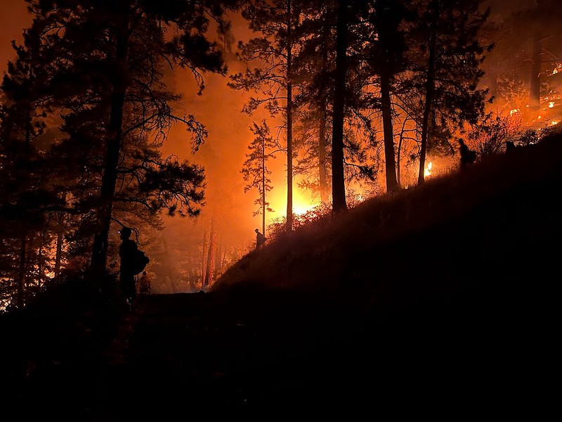
Photo credit: Midnight Sun IHC ( Night burnout operation in L48).
Fuel treatments like thinning and fuel breaks often help trees better survive wildfires in the western US but their biggest direct benefit lies with providing operational choices and opportunities to firefighting teams. Presentations at the 10th International Fire Ecology & Management Congress this past month in Monterey outlined research on whether treating vegetation fuels before a fire threatens are “worth it”. Alan Taylor’s team looked at fuel treatments in the 2021 Dixie fire which burned over 1,500 square miles in 5 northern California counties (suppression cost $637,000,000 but losses estimated at $1.5 billion). Research found that previous fire–within the past decade–reduced the fire severity by a third (based on tree death and damage). There were some exceptions, where recent burns with heavy grass/brush cover got “nuked” in the re-burn under the extreme heat and drought conditions that prevailed that year. The biggest variables correlated with increased fire severity were forest biomass (using NDVI as a proxy) and tree cover. Variables associated with decreased severity included maximum relative humidity and fire operations. The latter is interesting, since burnouts and backfires are a major part of strategies to combat gobbler fires like Dixie. Taylor, a fire ecology professor at Penn State, estimated that these tactics used by firefighters reduced the area which would have burned with high severity by about 22%. It should be noted that burnout operations in western US conifer forests are often conducted at night whereas in Alaska they are more often daytime operations.
Another research effort led by Lacey Hankins studied the effect of previous fuel treatments on outcomes of the 2022 Washburn Fire in Yosemite National Park. They used fire effects plot data and Lidar data but also interviewed fire operations staff to find out if previous roadside thinning or other forest management treatment shaped tactics. Yosemite’s fuel treatments, conducted since the 1970’s, reduced forest density and fuel load—especially ladder fuels. Operations personnel felt previous prescribed fires and strategically placed fuel treatments were key considerations in tactics and helped them protect the town and the giant sequoias in Mariposa Grove. Other presenters in the session described moderation of fire severity in shaded (thinned) treatments up to 20 years old in forests of the Sierra Nevadas, while in southern British Columbia, thinning treatments only worked to lower crowning and torching in the more aggressive treatments. Low intensity thinning (400-1,400 stems/ha) treatments did not reduce modeled fire intensity, nor did pruning (Rutherford, 2023).
—Cited Presentations—
Alan H. Taylor, et al. (2023) The contributions of past fires and fire management operations to severity patterns of the Dixie Fire, Presentation at 10th Intl Fire Congress, Monterey, CA, Dec. 5-7, 2023.
Lacey E. Hankin, et al. (2023) Linking forest management to operational outcomes of the Washburn Fire in Yosemite National Park, Presentation at 10th Intl Fire Congress, Monterey, CA, Dec. 5-7, 2023.
Kea Rutherford, et al. (2023) Are operational fuel treatments successfully mitigating wildfire risk in British Columbia, Canada? Presentation at 10th Intl Fire Congress, Monterey, CA, Dec. 5-7, 2023.
Recent studies by experts in Alaska and Canada have given us much new insight into the Drought Code (DC) component of the Fire Weather Index System used in both places. While other components of the FWI are simple in concept and easily validated by field observations, there have long been questions about the DC: what does it represent? How it should be interpreted and validated? How and if we should “overwinter” DC? How to convert DC to a moisture content (by weight or by volume) or vice versa? Canadian fire scientist Chelene Krezek-Hanes recently finished her PhD thesis, which reported on her extensive field work and remote sensing experiments and has yielded four published papers so far. Meanwhile, Alaska fire ecologist Eric Miller teamed up with University hydrology experts to validate the DC’s assumptions against field data in Alaska. Our latest Research Brief “Everything you wanted to know about the Drought Code in Alaska . . . but were afraid to ask” gives highlights of some of their findings: https://www.frames.gov/sites/default/files/AFSC/AFSC/Research/Brief/2023-4-final.pdf
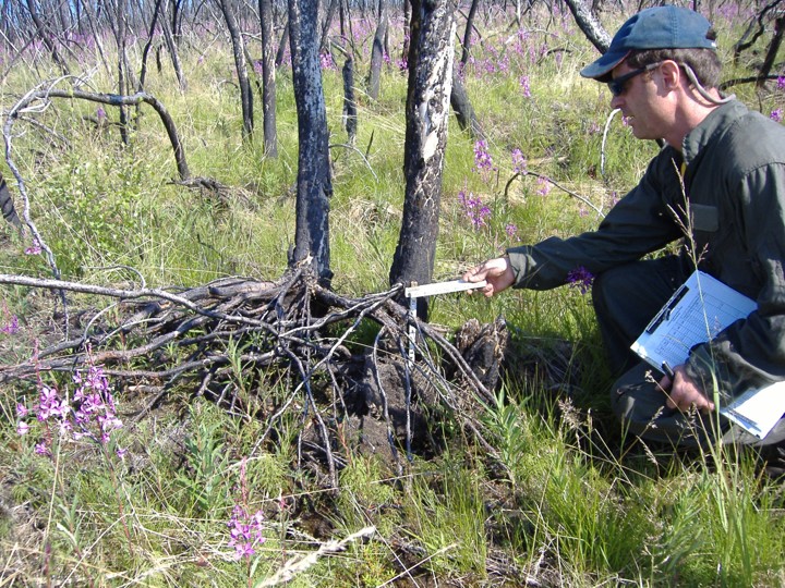
Smokes from East Fork Fire rise from tundra along the Yukon River around St. Mary’s, 6-12-2022. Credit: Jacob Welsh, AK IMT
Five years ago, Adam Young used paleofire evidence to hypothesize how climate warming would affect future tundra fires in Alaska. Adam basically predicted a big increase in tundra fire occurrence if the average July temperature warmed above a threshold of 13.4°C (56°F: Young, et al. 2017). This year, Arif Masrur et al. (2022) provided important evidence corroborating Adam’s theory using modern fire and climate records. The research team use machine learning to determine the relative importance of various climate, prior burn history, and biophysical values on tundra fire occurrence and size. They also tapped the rich collection of field plot data collected by the National Park Service and other management agencies for vegetation characteristics and verification of reburn status. Arif did, indeed, find a strong increase in recent Alaskan tundra fires concurrent with much warmer summers. Annual tundra burned area has almost doubled and reburned area has increased by 61% since 2010! The study also revealed a small but significant feedback effect of previous tundra fires on reburning, validating management strategies like using prescribed fire to reduce wildfire threat near villages.
Figure from Adam Young (2017) showing where he predicted shorter Fire Rotation Periods (more frequent fire) in Alaska with climate warming.
Young, AM, Higuera PE, Duffy PA and Hu FS. 2017. Climatic thresholds shape northern high-latitude fire regimes and imply vulnerability to future climate change Ecography 40:606–17. Slides and recording from Adam’s 2019 presentation on this study HERE: https://www.frames.gov/catalog/60348
Figure 2, Masrur, et al. 2022. [Tundra fire] Regime shift detected in mean annual fire frequency based on AICC fire perimeter data. The detections were performed with the target significance level p = 0.05 and cut-off length l = 20.
See also p. 24 WFOctNovDec2022 for updates on fuel break projects on the Kenai by Tracy Robillard.
Please also note a great Post-Doc opportunity with one of AFSC’s collaborating scientists to study boreal climate change impacts and mitigation methods. It pays well (~$68,000 year for two years) and comes with a lot of flexibility and opportunities for global scale collaboration. The ad is here: https://www.edf.org/jobs/cooley-postdoctoral-science-fellow
The face of a scientist: does that conjure an image of a certain gender, race, and age? Albert Einstein perhaps? Those stereotypes are changing: meet Dr. Yaping Chen–a rising star of science with a spectacular track record. The last 3 years she has come up with one mind-boggling revelation after another about how fire works in the Alaska tundra. After a MS degree in environmental engineering in China, Dr. Chen completed her PhD in the lab of the venerable Dr. Feng Sheng Hu at the University of Illinois. I first met her presenting a poster on the Nimrod Hill fire (Imuruk Lake, on the Seward Peninsula) at an American Geophysical Union meeting in 2019. The work was novel, ingenious, and suggestive of new ways to study fires with new computational and remote sensing tools. That was just the tip of the iceberg–or the thermokarst, if you will! Since then Dr. Chen has published numerous diverse research studies improving our understanding of dueling post-fire successional trajectories in tundra, improved burn severity mapping of legacy tundra fires, and fire regime effects on carbon balance. Her most recent paper outlines the role of tundra fire vs. climate warming in thawing permafrost in Alaska tundra statewide! If you’ve missed any of these important papers for your collection, links are included below. Now Dr. Chen is a post-doctoral researcher at the Virginia Institute of Marine Science, continuing her work on unraveling impacts of climate change. Thank you, Dr. Chen for all you’ve revealed to us in Alaska!
Below: Graphical Abstract from Chen, et al. 2021 One Earth publication, illustrating the increase in thermokarst rates across arctic Alaska, and highlighting impact of fire in hastening thaw.
In one handy paper that came out in 2021, Alaska fire analysts Robert “Zeke” Ziel and Chris Moore have compiled how-to’s, resources, fuel model-to-vegetation type crosswalks, and pro tips and secrets. The reference takes you all the way from introduction to the Canadian Forest Fire Danger Rating system to how to conduct an analysis of fire behavior in WFDSS (Wildfire Decision Support System used by fire agencies). Included are such perplexing topics as how to estimate live and dead fuel moisture, what are the available short-term and near-term fire models, what do do about winds, which National fuel models require “tweaking” in Alaska, and sources of vegetation map products and satellite imagery. Fire behavior analysts definitely want to review this before the fire season and make sure it’s handy in their kit if they plan to work in Alaska, and researchers will also find this an extremely useful state-of-the-art comprehensive review of how fire behavior analysis currently works in practice.
From the authors: “Alaska is faced with a unique fire management problem that has been handled in an interagency way for more than 30 years. The evolution of fire management has led to a different approach in interagency cooperation; weather data management; fire behavior and fire danger implementation; GIS management; and overall fire suppression strategies. This guide is intended to provide standardized inputs for initial analysis; these are not hard and fast rules to be strictly followed throughout an incident.”