Download the latest Roundup with brief highlights of new publications that may interest the Alaska fire science and management community HERE. The fall Roundup includes links to articles on improvements in ranking fire risk around communities and structures, new findings on changes in fire regime in Alaska and Canada, implications of increases in high latitude fire on the atmosphere, and interesting findings on toxic components in fire retardant chemicals. Here’s the URL to a downloadable version:
Also, if you missed this webinar, be sure to check out the recorded presentation “Spark to Strategy“–by Rick Thoman (ACCAP) and Jake Dollard (Alaska Fire Service) on the 2024 fire season and how fire management plans turn into actions in Alaska.
Caribou lichens, Cladonia (Cladina) spp., are a slow-growing, vital winter forage for caribou. They are commonly called “reindeer moss” but aren’t really moss. And they are important to both reindeer and to caribou. Eric Palm (2022), for his PhD thesis, used GPS-collared caribou locations from several agencies in Alaska to show that caribou strongly avoided burned areas, especially in winter, and that their preference was related to lichen abundance. He concluded that: “caribou will experience increasing winter habitat loss as fire frequency and severity increase [in a warmer climate]. . . .We suggest that management strategies prioritizing protection of core winter range . . . would provide important climate-change refugia for caribou.” In a separate study, Matt Macander et al. (2020) demonstrated effective satellite mapping of lichen-rich ranges in Alaska, and his analyses also reinforced the caribou preference for habitat areas with >30% lichen cover.
Often you hear that lichens are only important in winter, but Libby Ehler (2021) used GPS video collars as well as diet analysis from droppings to show that lichens dominated caribou summer diet for the Alaska Fortymile Herd: 59% of composition of fecal pellets and 39% of observed foraging on the video collars in summer was lichen (vs. 37% shrubs). Only in June and July did the videos record a little more browsing on shrub than lichen, and in winter caribou expend a lot of energy locating and digging for rich patches of ground-hugging lichens. Previous studies demonstrated similar diet dominance by lichens in other herds in Alaska and Canada.
Now, in a new study, Liming He, of Natural Resources Canada, has documented large-scale decline in these lichen habitats in Eastern Canada. His study derived caribou lichen cover maps for two time periods ~30 years apart (1980’s, & 2020’s) using Landsat satellite imagery for a large area including several boreal caribou population ranges. Lichen cover declined in 62% of the region evaluated and increased in 11%. Fires were responsible for a quarter of the decrease, even in a region of Canada where fires have been relatively rare. The larger part (3/4) remains unexplained, with warming-induced shrub encroachment high on the list of suspects. Although we do not yet have a comparable study for Alaska, Macander et al. (2022) found lichen had declined 13% as a plant functional type in Alaska from 1985-2020, in a study that also used Landsat satellite data.
Taken together, these studies should alert wildlife and land managers about a possible habitat crisis on the horizon for Alaska’s 2nd largest subsistence resource. Indeed, most caribou herds across North America are experiencing declines, including the Western Arctic Caribou herd—once Alaska’s largest—featured in a recent Alaska Beacon article. The George River Caribou Herd in eastern Canada was the world’s largest in the 1990’s (800,000 animals) but by 2022 was down to just 7,200. Part of that herd’s decline is thought to be based on habitat degradation from overuse.
Can’t help but notice with this year’s fires in interior Alaska, some burned readily into recent (<20 year old) burn scars, like the Delta fire, Hillbilly and Ponds fires southeast of Fairbanks (figure). Fires to the southwest (Clear Ck and Rock Ck) are re-burning 1950’s and 1960’s burn scars but more recent burn perimeters seem to be working as fuel breaks. Fire management agencies in Alaska have traditionally relied on burn scars to act as fuel breaks, stopping or significantly moderating fire spread, for up to 50 years post-fire (Cronan and Jandt, 2008). In the 21st century, however, the phenomenon of early fire re-entry into old burns is becoming more common (Barnes 2017, Buma 2022).
While a student at UAF, Rafael Rodriguez (forestry technician with the State of Alaska in Fairbanks) showed a strong correlation between the number of times an area had burned between 1940-2010 with mean July temperature (Rodriguez 2014). In 2023, late July and August brought ideal weather for late season wildfires to the interior. Burning still exerts a strong negative feedback on re-burning within 10 years of a fire, and overall only about 4% of burned area in Alaska has burned more than once in the last 30 years (Buma, et al. 2023). Still the phenomenon of early fire re-entry, driven both by warming climate/drying fuels and by forest conversion to grassland or scrub, is very impactful for fire management decisions and agencies are carefully monitoring the trend.
Alaska Midnight Sun crew boards a bus to head for a Canadian fire assignment June 4, 2023 (Photo credit: Beth Ipsen, BLM Alaska Fire Service)
Why is the Alaska fire season so quiet this year while Canada has major wildfires? Alaska climatologist Rick Thoman attributes the lack of fires in Alaska (only 934 acres burned by the end of June) to a lack of lightning as well as cooler, moister weather this year (Alaska June 2023 Sea Ice and Wildfire). Interesting that this year Alaska retained a lot more sea ice in the Chukchi sea and Arctic Ocean above Barrow: there is some evidence linking regional climate to sea ice concentration (Zou, et al. 2021). Meanwhile, Canada is breaking records with 22.7 million acres burned (9.2 million ha) as of July 9. CiFC (https://ciffc.ca/) reports 3,678 fires spread across the entire country. Canadian and US cities (including Detroit, Pittsburgh, and Chicago) have been suffering poor air quality for much of the mid-summer with little relief in site. Is there an explanation for the unusual pattern? The global temperature anomaly for May (figure) may be one clue. Strong linkages have been found between warm temperatures and wildfire activity, mainly because of accelerated drying of vegetation fuels. In the western US, Abatzoglou and Williams (2016) found that human-caused climate change caused over half of the documented increases in fuel aridity since the 1970s and doubled the cumulative forest fire area since 1984. At any rate, 2023 brought very little snow to eastern Canada, so it melted early and Fire Weather Indices have been unusually high.
Figure from Scott Duncan (ScottDuncanWX@twitter.com)
Fire regime is changing in other parts of the world. Rebecca Scholten is finishing up a PhD in Amsterdam studying weather patterns which correlate with fire activity around the north, especially arctic areas. She’s noted that changes in the polar jet stream driven by warming global temperature seem to be correlated with more wildfire in northern tundra ecosystems. A simplified explanation would be that a “wobbly” polar jet stream caused by weaker cold sink over the Arctic can mean calming in mid-latitudes but intense heat domes, dry and windy conditions, and more convection over high northern latitudes. There seems to be a strong link with these conditions and the Siberian megafires in 2019-2021. Her recent paper in Science points to accelerating changes in high latitudes with earlier snowmelt and a tripling in the frequency of this “Arctic front jet pattern.” Curiously, when this pattern sets up, it may moderate conditions–at least with respect to winds–over interior Alaska!
Citations:
Zou, et al 2021. Increasing large wildfires over the western United States linked to diminishing sea ice in the Arctic. Nat Commun 12, 6048. https://doi.org/10.1038/s41467-021-26232-9
Abatzoglou and Williams. 2016. Impact of anthropogenic climate change on wildfire across western US forests. PNAS 113 (42) 11770-11775. https://doi.org/10.1073/pnas.1607171113
Scholten, R.C. et al. 2022. Early snowmelt and polar jet dynamics co-influence recent extreme Siberian fire seasons. Science 378, 1005–1009. https://doi.org/10.1126/science.abn4419
Smokes from East Fork Fire rise from tundra along the Yukon River around St. Mary’s, 6-12-2022. Credit: Jacob Welsh, AK IMT
Five years ago, Adam Young used paleofire evidence to hypothesize how climate warming would affect future tundra fires in Alaska. Adam basically predicted a big increase in tundra fire occurrence if the average July temperature warmed above a threshold of 13.4°C (56°F: Young, et al. 2017). This year, Arif Masrur et al. (2022) provided important evidence corroborating Adam’s theory using modern fire and climate records. The research team use machine learning to determine the relative importance of various climate, prior burn history, and biophysical values on tundra fire occurrence and size. They also tapped the rich collection of field plot data collected by the National Park Service and other management agencies for vegetation characteristics and verification of reburn status. Arif did, indeed, find a strong increase in recent Alaskan tundra fires concurrent with much warmer summers. Annual tundra burned area has almost doubled and reburned area has increased by 61% since 2010! The study also revealed a small but significant feedback effect of previous tundra fires on reburning, validating management strategies like using prescribed fire to reduce wildfire threat near villages.
Figure from Adam Young (2017) showing where he predicted shorter Fire Rotation Periods (more frequent fire) in Alaska with climate warming.
Young, AM, Higuera PE, Duffy PA and Hu FS. 2017. Climatic thresholds shape northern high-latitude fire regimes and imply vulnerability to future climate change Ecography 40:606–17. Slides and recording from Adam’s 2019 presentation on this study HERE: https://www.frames.gov/catalog/60348
Figure 2, Masrur, et al. 2022. [Tundra fire] Regime shift detected in mean annual fire frequency based on AICC fire perimeter data. The detections were performed with the target significance level p = 0.05 and cut-off length l = 20.
See also p. 24 WFOctNovDec2022 for updates on fuel break projects on the Kenai by Tracy Robillard.
Please also note a great Post-Doc opportunity with one of AFSC’s collaborating scientists to study boreal climate change impacts and mitigation methods. It pays well (~$68,000 year for two years) and comes with a lot of flexibility and opportunities for global scale collaboration. The ad is here: https://www.edf.org/jobs/cooley-postdoctoral-science-fellow
To thwart runaway climate warming, the global community is struggling to find strategies to limit carbon dioxide (CO2) emissions that are steeply climbing. Increasing boreal wildfires in Alaska and Canada also threaten to increase CO2 emissions and could contribute potentially 12 gigatons to the world’s carbon headache by mid-century.
Fire Management strategy could make a difference: A research team from The Woodwell Climate Research Center and Union of Concerned Scientists wondered whether fire management offered a realistic way to slow down the release of legacy carbon in boreal forests, giving Nature and humans time to adapt and implement other mitigation strategies. How much would it cost to keep Alaskan wildfires at their historic level, avoiding climate-induced predicted increases? And was it even possible to make a difference? In short, the study found that—yes—more fire suppression could keep nearly 1/3 (4 Gt ) of that carbon in the ground in Alaska and Canada. The study tries to estimate costs associated with carbon savings and compares them to other carbon-sparing strategies being used or planned. Project goals are below are from a presentation given to Alaskan fire managers last fall.
Download our short Research Brief above (and/or you can access the full scientific article, open access, HERE:
Phillips, et al. 2022.
Escalating carbon emissions from North American boreal forest wildfires and the climate mitigation potential of fire management.
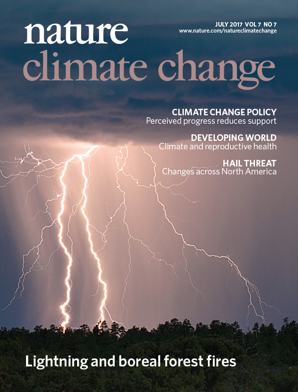
Our Research Brief this month covers a new NASA-funded study led by Sander Veraverbeke of Vrije Universiteit in Amsterdam which found lightning storms to be a main driver of recent large fire seasons in Alaska and Canada. Results of the study are published in the July, 2017 issue of Nature Climate Change.
July 2017 Nature Climate Change
MODIS (Moderate-Resolution Imaging Spectroradiometer) satellite images and data from ground-based lightning networks were employed to study fire ignitions. Sander’s analysis found increases of between two and five percent a year in the number of lightning-ignited fires since 1975. Veraverbeke said that the observed trends are consistent with climate change, with higher temperatures linked to both more burning and more thunderstorms.
Study co-author Brendan Rogers at Woods Hole Research Center in Massachusetts says these trends are likely to continue. “We expect an increasing number of thunderstorms, and hence fires, across the high latitudes in the coming decades as a result of climate change.” This is confirmed in the study by different climate model outputs.
Charles Miller of NASA’s Jet Propulsion Laboratory in California, another co-author, said while data from Alaska’s agency lightning networks were critical to this study, it is challenging to use these data to verify trends because of continuing network upgrades. “A spaceborne sensor that provides lightning data that can be linked with fire dynamics would be a major step forward,” he said. Such a sensor exists already– NASA’s spaceborne Optical Transient Detector –but it’s geostationary orbit limits its utility for high latitudes.
The researchers found that the fires are creeping farther north, near the transition from boreal forests to Arctic tundra. “In these high-latitude ecosystems, permafrost soils store large amounts of carbon that become vulnerable after fires pass through,” said co-author James Randerson of the University of California, Irvine. “Exposed mineral soils after tundra fires also provide favorable seedbeds for trees migrating north under a warmer climate.”
The Alaska Fire Science Consortium at the University of Alaska, Fairbanks, also participated in the study, and provides this 2-page Research Brief executive summary.
Citation: Veraverbeke, S., B.M. Rogers, M.L. Goulden, R.R. Jandt, C.E. Miller, E.B. Wiggins and J.T. Randerson. Lightning as a major driver of recent large fire years in North American boreal forests. Nature Climate Change 7: 529–534 (2017). DOI: 10.1038/nclimate3329
April Melvin of EPA’s National Climate Change Division has spent some time in the field in Alaska. In a just-released publication her research team takes a look at how firefighting costs in Alaska are likely to change through the next several decades.
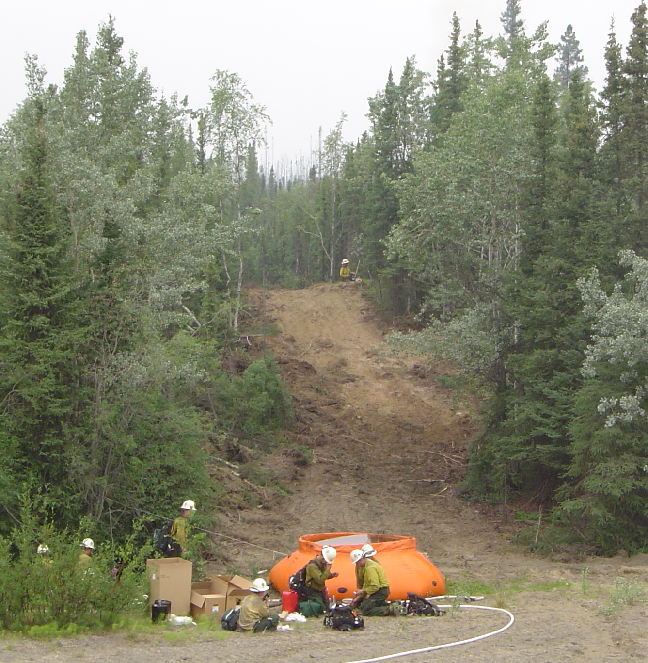
“Pumpkin” water bladder preparing burnout on the Chicken fire 2004. Photo by Cyle Wold, USFS-PNW.
They use the ALFRESCO model developed at UAF, which simulates fire ignition and spread (annual timesteps) under different climate projections in 100-km grid cells. Read their paper (citation below) for all the details, but in a nutshell they found: 1) it’s hard to nail down precise fire cost records in the multi-jurisdictional setting! 2) Fire costs go up in the future and the biggest expenditures will be in the Full fire protection option. 3) by 2030, predicted federal fire suppression costs (not including base–support and pre-suppression) will average $27-47M annually under the RCP 4.5 (moderate emissions) climate projection. That compares to about $31M on average from 2002-2013. Adding in state costs boosts this to about $116M total firefighting cost for Alaska assuming the state costs are still roughly 68% of the total cost. Again this does not include base operating costs. The paper provides some good analysis for fire protection agencies to take to the bank. Or at least to the Legislature!
As climate warming brings more wildfire to the North, scientists and citizens wonder how the landscape will be transformed. Will forests continue their 2000’s-era trend toward less spruce and more hardwoods, catalyzed by larger fires and more frequent burning? If so, that might slow down the trend for larger and more intense fires. However, will hotter summers with more effective drying lead to increased fire re-entry into the early successional hardwoods, making them less strategic barriers for fire protection? A research team modeling the former question just unveiled an interactive web tool to model forest changes under various future climate scenarios (Feb. 1 webinar recording available HERE). With the new web tool, funded by JFSP, Paul Duffy and Courtney Schultz will be working with fire managers in Alaska to look at fire occurrence and cost in the future. Try it for yourself at http://uasnap.shinyapps.io/jfsp-v10/