A recent paper by Lucas Diaz, et al. (2026) builds upon previous work to more accurately estimate the carbon impact of southwest Alaska tundra fires. When Moubarak, et al. 2023 studied the after-effects of the 2015 tundra fires, they found that 910,000 metric tons of carbon were released in emissions alone from the 134,000 acres of fires in that region. More recently, Diaz’ team studied the 2022 Apoon Pass/East Fork fires in southwest Alaska using similar methods to tie field measurements to satellite-generated burn severity metrics. Just these two fires in 2022 released the carbon equivalent of 6,876,178 barrels of oil, not counting any post-fire release due to permafrost thaw, nor the carbon footprint of the fire suppression efforts. Tussock tundra emitted an average of 1.59 ± 0.55 kg C m−2 during combustion. In 2022 burn depth averaged 7 cm, so only 11% of the total pre-fire carbon stock was consumed–mostly duff organic soil. These estimates compare favorably with Moubarak’s earlier findings of 1.68 kg C m−2 for the 2015 tundra fires. Moubarak further calculated that those fires would have a warming impact on the atmosphere for about 80 years, given the long residence time of CO2 in the atmosphere. Links to these Open Access articles are below:
Reconnaissance flight June 10, 2022, East Fork Fire in southwest Alaska. Photo: Justin Johansen.
Alaskans know we must live with fire. A new open-access article in iScience synthesizes recent fuel break research from Alaska and Yukon, drawing on input from rural community representatives and scientists alike. The study presents a compelling case: fuel breaks designed with “co-benefits” can add ecological and socio-economic value while increasing social acceptance. The research highlights opportunities to move beyond traditional fuel break approaches toward more adaptive and ecologically informed designs. These innovations include tailoring fuel breaks to local vegetation, integrating them with natural landscape features, and aligning placement with suppression and community protection goals.
Citation:Link, NT; JF Johnstone, XJ Walker, F Amundsen, HK Berrios, L Bibeau, K Cooley, AC Erickson, C Johnston, JM Little, N Lowjewski, AD Perrin, CA Phillips, S Potter, DC Rees, LB Saperstein, JE Schmidt, EE Sousa, KV Spellman, A Spring, and MC Mack. 2025.Mitigating increasing wildfire risk through fuel break innovations.iScience. Open Access.
Image credit:Victor Leshyk, Center for Ecosystem Science and Society, Northern Arizona University
Wildfires are becoming larger and more severe as the climate shifts in the far north. Fuel breaks are a tool to proactively mitigate risk, but they are expensive, require maintenance, and come with side effects that are sometimes unwelcome to locals. Is there a better path forward?
TheFuel Breaks with Benefits project addresses this question, exploring benefits to communities and ecosystems that could make fuel break planning more effective and appealing. The project established a network of northern experts from many knowledge systems and sectors in Alaska, Yukon, British Columbia, and Northwest Territories to assess opportunities for developing fuel reduction treatments with sustainable social-ecological benefits in boreal forests. The authors emphasize that fuel breaks are not a standalone solution—they are most effective when combined with broader wildfire management strategies, including land-use planning, community preparedness, and fire-smart development practices.
Many of you will recall the work Badola and Panda have been doing at UAF to test development of low-cost, detailed vegetation maps for boreal Alaska using widely available Sentinel-2 satellite data. Fire managers challenged Anushree Badola (for her PhD work) to make fuels maps that were more accurate than LANDFIRE and better separated black spruce from mixed and deciduous forest types. That work (and her doctorate) was completed last year, and indeed, for the interior Alaska testing site, they appear to be twice as accurate as LANDFIRE at a 30m resolution and do a good job of distinguishing forest types. But did you know that she has made those maps (which cover most of Alaska with the exception of the western end of the Seward Peninsula and the North Slope) available for free download? All is explained succinctly in her STORYMAP and there is also a 2-minute video refresher by Anushree about the project, which was sponsored by National Science Foundation grants and the State of Alaska, with lots of input from the fire management community. Here’s a screenshot from the Storymap as a teaser!
New data compiled in NOAA’s 2024 Arctic Report card illuminates the delicate balance between boreal/arctic regions production of carbon dioxide (especially fire smoke and microbial respiration) and it’s uptake (by photosynthesizing vegetation). This balance is sensitive to ambient temperature, and of course is influenced in various ways by wildfire. Slowing down the atmospheric increase in CO2 from burning fossil fuels has taken on some urgency as we see more and more adverse impacts from warmer atmosphere and oceans due to its greenhouse effects. Land management and fire management may have a role to play, especially as we race to develop alternative energy sources. Take a look at this well-illustrated 8-p summary to bring yourself up to speed with what’s happening with carbon in the north country. Link to the report: https://doi.org/10.25923/0gpp-mn10
“When including wildfire emissions, the Arctic tundra region has shifted to a carbon dioxide (CO2) source and is a consistent methane (CH4) source.” (Natali et al. 2024, NOAA Technical Report OAR ARC ; 24-11)
Photo by R. Reanier: Anaktuvuk R Fire, July 14, 2007
A recent study headed by the University of Washington is catching national media attention currently as it points to a connection between exposure to wildfire smoke and dementia in older adults from a large study in California. One new advance is the ability to distinguish between ambient wildfire smoke vs. other types of fine particulate matter (PM2.5) exposure. Although the team’s publication in PubMed is pay-walled (Elser, et al. 2024), you can read a concise description of their work in this November, 2024 Research Highlight by the NIH National Institute on Aging, by Brian Doctrow, PhD. In a nutshell, among 1.2 million Californians aged 60+, there did seem to be a connection between neighborhood wildfire PM2.5 exposure and dementia diagnosis, which was considerably stronger than the connection with other types of fine particulate exposure. For every 1 μg/m3 increase in average wildfire PM2.5, the odds of receiving a dementia diagnosis increased by 18%.
Matsu engine protecting Nenana during the Parks Highway fire, 2006 (Photo: State of Alaska, DNR).
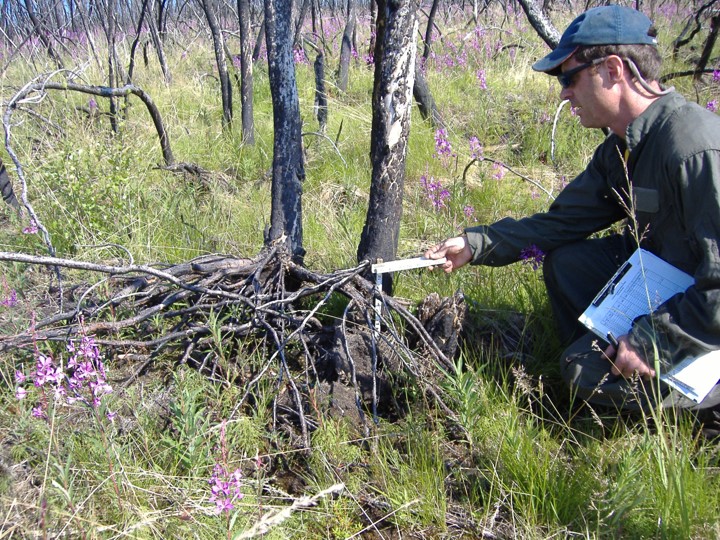
Caribou lichens, Cladonia (Cladina) spp., are a slow-growing, vital winter forage for caribou. They are commonly called “reindeer moss” but aren’t really moss. And they are important to both reindeer and to caribou. Eric Palm (2022), for his PhD thesis, used GPS-collared caribou locations from several agencies in Alaska to show that caribou strongly avoided burned areas, especially in winter, and that their preference was related to lichen abundance. He concluded that: “caribou will experience increasing winter habitat loss as fire frequency and severity increase [in a warmer climate]. . . .We suggest that management strategies prioritizing protection of core winter range . . . would provide important climate-change refugia for caribou.” In a separate study, Matt Macander et al. (2020) demonstrated effective satellite mapping of lichen-rich ranges in Alaska, and his analyses also reinforced the caribou preference for habitat areas with >30% lichen cover.
Often you hear that lichens are only important in winter, but Libby Ehler (2021) used GPS video collars as well as diet analysis from droppings to show that lichens dominated caribou summer diet for the Alaska Fortymile Herd: 59% of composition of fecal pellets and 39% of observed foraging on the video collars in summer was lichen (vs. 37% shrubs). Only in June and July did the videos record a little more browsing on shrub than lichen, and in winter caribou expend a lot of energy locating and digging for rich patches of ground-hugging lichens. Previous studies demonstrated similar diet dominance by lichens in other herds in Alaska and Canada.
Now, in a new study, Liming He, of Natural Resources Canada, has documented large-scale decline in these lichen habitats in Eastern Canada. His study derived caribou lichen cover maps for two time periods ~30 years apart (1980’s, & 2020’s) using Landsat satellite imagery for a large area including several boreal caribou population ranges. Lichen cover declined in 62% of the region evaluated and increased in 11%. Fires were responsible for a quarter of the decrease, even in a region of Canada where fires have been relatively rare. The larger part (3/4) remains unexplained, with warming-induced shrub encroachment high on the list of suspects. Although we do not yet have a comparable study for Alaska, Macander et al. (2022) found lichen had declined 13% as a plant functional type in Alaska from 1985-2020, in a study that also used Landsat satellite data.
Taken together, these studies should alert wildlife and land managers about a possible habitat crisis on the horizon for Alaska’s 2nd largest subsistence resource. Indeed, most caribou herds across North America are experiencing declines, including the Western Arctic Caribou herd—once Alaska’s largest—featured in a recent Alaska Beacon article. The George River Caribou Herd in eastern Canada was the world’s largest in the 1990’s (800,000 animals) but by 2022 was down to just 7,200. Part of that herd’s decline is thought to be based on habitat degradation from overuse.
As one significant boreal research project (the NASA Arctic Boreal Variability Experiment) winds down, another important research collaboration is winding up, thanks to hard work by a group of scientists in Bonanza Creek Long-Term Ecological Research unit (BNZ-LTER). Both projects have tackled important fire science and management issues in Alaska. Although BNZ-LTER grew from the Bonanza Creek Experimental Forest (beginning in the 1980’s) and Caribou-Poker Creek Watershed, it’s work now expands across Alaska and western Canada and includes collaborating researchers from many locations, but especially University of Alaska and Northern Arizona University. BNZ-LTER also welcomes broad collaboration from land and resource managers and community stakeholders.
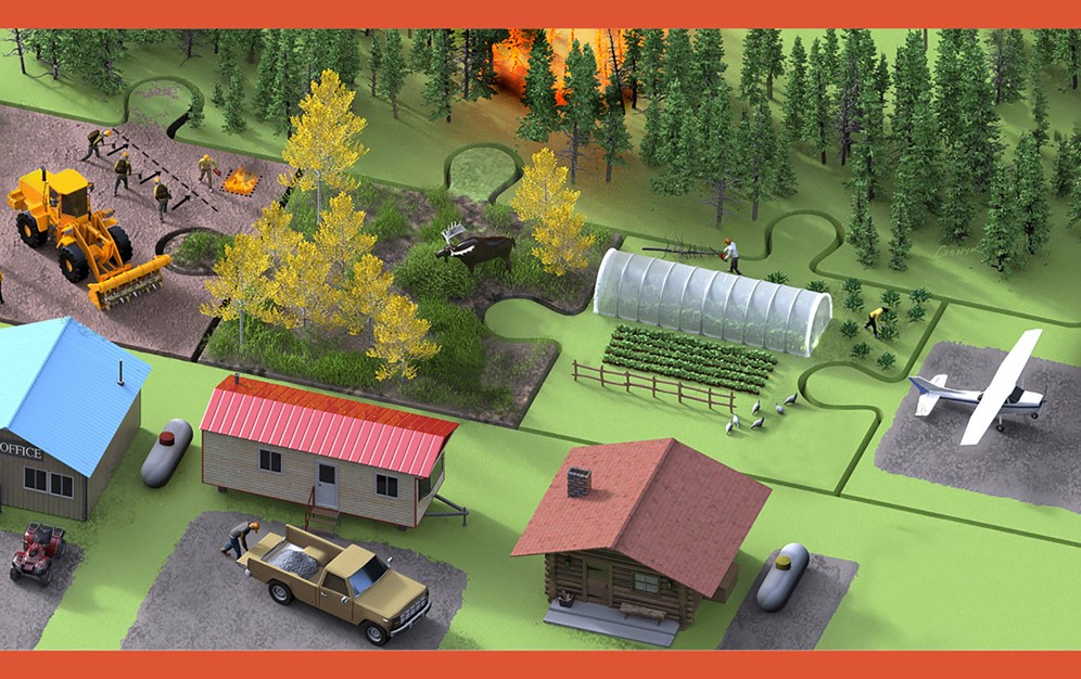
Research at the BNZ-LTER has always had a strong wildfire component.Dr Michelle Mack leads the unit as their Principal Investigator, as well as heading Northern Arizona University’s (NAU) Plant and Ecosystem Ecology Research Lab. In May 2023, Dr. Mack and her team were awarded a renewed grant of $7.6 m from the National Science Foundation for support through 2029. The project, titled Changing Disturbances, Ecological Legacies, and the Future of the Alaskan Boreal Forest, has several subtopics, including a Wildfire Working Group led by Dr. Xanthe Walker (NAU). The wildfire group is studying direct and indirect effects of fire, such as seedling re-establishment, effect on soil microbes, overwintered fires and stream chemistry. They are also studying fire management activities like fuel breaks. One recent publication by Walker, Mack, Johnstone, and others is highlighted in our latestResearch Brief: When does fire change a spruce forest into hardwoods?The paper discusses what has been learned from the LTER’s extensive network of post-fire forest plots on drivers and thresholds of stand-type conversions—a hot topic for a number of management applications.
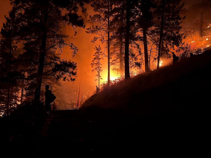
Photo credit: Midnight Sun IHC ( Night burnout operation in L48).
Fuel treatments like thinning and fuel breaks often help trees better survive wildfires in the western US but their biggest direct benefit lies with providing operational choices and opportunities to firefighting teams. Presentations at the 10th International Fire Ecology & Management Congress this past month in Monterey outlined research on whether treating vegetation fuels before a fire threatens are “worth it”. Alan Taylor’s team looked at fuel treatments in the 2021 Dixie fire which burned over 1,500 square miles in 5 northern California counties (suppression cost $637,000,000 but losses estimated at $1.5 billion). Research found that previous fire–within the past decade–reduced the fire severity by a third (based on tree death and damage). There were some exceptions, where recent burns with heavy grass/brush cover got “nuked” in the re-burn under the extreme heat and drought conditions that prevailed that year. The biggest variables correlated with increased fire severity were forest biomass (using NDVI as a proxy) and tree cover. Variables associated with decreased severity included maximum relative humidity and fire operations. The latter is interesting, since burnouts and backfires are a major part of strategies to combat gobbler fires like Dixie. Taylor, a fire ecology professor at Penn State, estimated that these tactics used by firefighters reduced the area which would have burned with high severity by about 22%. It should be noted that burnout operations in western US conifer forests are often conducted at night whereas in Alaska they are more often daytime operations.
Another research effort led by Lacey Hankins studied the effect of previous fuel treatments on outcomes of the 2022 Washburn Fire in Yosemite National Park. They used fire effects plot data and Lidar data but also interviewed fire operations staff to find out if previous roadside thinning or other forest management treatment shaped tactics. Yosemite’s fuel treatments, conducted since the 1970’s, reduced forest density and fuel load—especially ladder fuels. Operations personnel felt previous prescribed fires and strategically placed fuel treatments were key considerations in tactics and helped them protect the town and the giant sequoias in Mariposa Grove. Other presenters in the session described moderation of fire severity in shaded (thinned) treatments up to 20 years old in forests of the Sierra Nevadas, while in southern British Columbia, thinning treatments only worked to lower crowning and torching in the more aggressive treatments. Low intensity thinning (400-1,400 stems/ha) treatments did not reduce modeled fire intensity, nor did pruning (Rutherford, 2023).
—Cited Presentations—
Alan H. Taylor, et al. (2023) The contributions of past fires and fire management operations to severity patterns of the Dixie Fire, Presentation at 10th Intl Fire Congress, Monterey, CA, Dec. 5-7, 2023.
Lacey E. Hankin, et al. (2023) Linking forest management to operational outcomes of the Washburn Fire in Yosemite National Park, Presentation at 10th Intl Fire Congress, Monterey, CA, Dec. 5-7, 2023.
Kea Rutherford, et al. (2023) Are operational fuel treatments successfully mitigating wildfire risk in British Columbia, Canada? Presentation at 10th Intl Fire Congress, Monterey, CA, Dec. 5-7, 2023.
Recent studies by experts in Alaska and Canada have given us much new insight into the Drought Code (DC) component of the Fire Weather Index System used in both places. While other components of the FWI are simple in concept and easily validated by field observations, there have long been questions about the DC: what does it represent? How it should be interpreted and validated? How and if we should “overwinter” DC? How to convert DC to a moisture content (by weight or by volume) or vice versa? Canadian fire scientist Chelene Krezek-Hanes recently finished her PhD thesis, which reported on her extensive field work and remote sensing experiments and has yielded four published papers so far. Meanwhile, Alaska fire ecologist Eric Miller teamed up with University hydrology experts to validate the DC’s assumptions against field data in Alaska. Our latest Research Brief “Everything you wanted to know about the Drought Code in Alaska . . . but were afraid to ask” gives highlights of some of their findings: https://www.frames.gov/sites/default/files/AFSC/AFSC/Research/Brief/2023-4-final.pdf
Smokes from East Fork Fire rise from tundra along the Yukon River around St. Mary’s, 6-12-2022. Credit: Jacob Welsh, AK IMT
Five years ago, Adam Young used paleofire evidence to hypothesize how climate warming would affect future tundra fires in Alaska. Adam basically predicted a big increase in tundra fire occurrence if the average July temperature warmed above a threshold of 13.4°C (56°F: Young, et al. 2017). This year, Arif Masrur et al. (2022) provided important evidence corroborating Adam’s theory using modern fire and climate records. The research team use machine learning to determine the relative importance of various climate, prior burn history, and biophysical values on tundra fire occurrence and size. They also tapped the rich collection of field plot data collected by the National Park Service and other management agencies for vegetation characteristics and verification of reburn status. Arif did, indeed, find a strong increase in recent Alaskan tundra fires concurrent with much warmer summers. Annual tundra burned area has almost doubled and reburned area has increased by 61% since 2010! The study also revealed a small but significant feedback effect of previous tundra fires on reburning, validating management strategies like using prescribed fire to reduce wildfire threat near villages.
Figure from Adam Young (2017) showing where he predicted shorter Fire Rotation Periods (more frequent fire) in Alaska with climate warming.
Young, AM, Higuera PE, Duffy PA and Hu FS. 2017. Climatic thresholds shape northern high-latitude fire regimes and imply vulnerability to future climate change Ecography 40:606–17. Slides and recording from Adam’s 2019 presentation on this study HERE: https://www.frames.gov/catalog/60348
Figure 2, Masrur, et al. 2022. [Tundra fire] Regime shift detected in mean annual fire frequency based on AICC fire perimeter data. The detections were performed with the target significance level p = 0.05 and cut-off length l = 20.