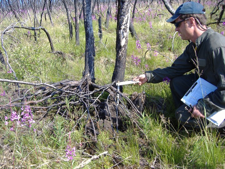
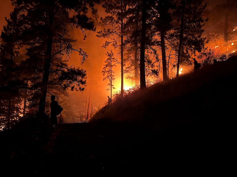
Upgrading Satellite Mapping of Burn Severity

As discussed in the Feb. 7 Fire Science Highlight, burn severity in Alaska is best related to the amount of consumption of the forest floor—not the degree of tree canopy mortality as is in temperate pine and fir forest.  Yet the most commonly applied metric to map burn severity using satellite remote sensing does not correlate well with substrate burn severity.  The change in Normalized Burn Ratio (dNBR; Key and Benson 2003) is based on comparing a pre- and a post-fire image. However, NBR thresholds for severity differ from one fire to another and among different years: similar numbers don’t indicate the same severity levels (D. Chen et al. 2020).  And with tundra fires, sometimes it works, other times not.  This problem has dogged fire effects and ecology studies in Alaska for some time (see list of papers in Sean Parks November 2019 presentation) leading French et al. (2008) to conclude: “Satellite remote sensing of post-fire effects alone without proper field calibration should be avoided.”

ARF63_0-50m_2008

2008 Transect photo from Anaktuvuk River tundra fire (R. Jandt)

Recently, we’ve seen some promising new methods used to improve satellite remote sensing of burn severity in boreal forest.  Whitman et al. compared several indices including a relativized index that facilitated comparisons between different fires in Canada.  She told us about it at the Opportunities to Apply Remote Sensing in Boreal/Arctic Wildfire Management and Science Workshop in 2017—here’s her presentation if you missed it: Improving Remotely Sensed Multispectral Estimations of Burn Severity in Western Boreal Forests.  Loboda et al. ( 2020) found single images using just NIR (near-infrared) bands of Landsat did better than NBR in discriminating tundra fire severity.  Sean Parks is attempting to harness the power of Google Earth Engines and cloud-based computing to use multiple images to further define the ecological burn severity (Parks et al. 2019)—this work is kicking off at the University of Montana.  He also found that unusual aspects of some fires in Alaska (pre-existing beetle kill, short fire return interval) contribute to poor performance of the standard index (see his recorded November, 2019, Association of Fire Ecology meeting presentation HERE).  And Yaping Chen, from the University of Illinois, explored using indices based on Visible and NIR bands (which have a large archive of available imagery going back to the early 1970’s) to evaluate tundra fire severity.  Her paper (Y. Chen et al. 2020) points to a VNIR index called GEMI as a “robust surrogate to NBR in Arctic tundra ecosystems, capable of accurately estimating fire severity across fire seasons, tundra fires, ecoregions, and vegetation types.”  The fact that GEMI is not as influenced by different vegetation types as dNBR gives it a distinct advantage mapping tundra burn severity.

Being able to more accurately map burn severity levels from space would give ecologists a boost for understanding why fires sometimes induce radical changes in ecosystems while other times the system self-replaces in a very short span.  For example, Yaping Chen used GEMI to reconstruct burn severity on older tundra fires like the 1977 example below and tie it to thermokarst effects (like catastrophic lake drainage or ponding) resulting from the fires (poster presented at AGU meeting December 2019).  We look forward to more exciting products and tools coming from these research teams!

Y. Chen et al. 2020, Fig. 7

Reconstructed fire severity map of the 1977 OTZNNW 38 tundra fire computed with dGEMI using Landsat MSS imagery.

Citations:

Chen, Yaping; Lara, Mark J.; Hu, Feng Sheng. 2020. A robust visible near-infrared index for fire severity mapping in Arctic tundra ecosystems. ISPRS Journal of Photogrammetry and Remote Sensing 159:101-113.

Chen, Dong; Loboda, TV.; Hall, JV. 2020. A systematic evaluation of influence of image selection process on remote sensing-based burn severity indices in North American boreal forest and tundra ecosystems. ISPRS Journal of Photogrammetry and Remote Sensing 159:63-77.

French, NHF.; Kasischke, ES.; Hall, RJ.; Murphy, KA.; Verbyla, DL.; Hoy, EE.; Allen, JL. 2008. Using Landsat data to assess fire and burn severity in the North American boreal forest region: an overview and summary of results. International Journal of Wildland Fire 17(4): 443-462.

Key, Carl H.; Benson, NC. 2003. The normalized burn ratio (NBR): A Landsat TM radiometric measure of burn severity. US Geological Survey Northern Rocky Mountain Science Center.

Loboda, Tatiana V.; Hoy, EE.; Giglio, L; Kasischke, ES. 2011. Mapping burned area in Alaska using MODIS data: a data limitations-driven modification to the regional burned area algorithm. International Journal of Wildland Fire 20(4):487-496.

Parks, SA.; Holsinger, LM.; Koontz, MJ.; Collins, L; Whitman, E; Parisien, MA; Loehman, RA.; Barnes, JL.; Bourdon, JF; Boucher, J; Boucher, Y; Caprio, AC.; Collingwood, A; Hall, RJ.; Park, J; Saperstein, LB.; Smetanka, C; Smith, RJ.; Soverel, NO. 2019. Giving ecological meaning to satellite-derived fire severity metrics across North American forests. Remote Sensing 11(14):1735.

Whitman, E, MA Parisien, DK Thompson, RJ Hall, RS Skakun, and MD Flannigan. 2018. Variability and drivers of burn severity in the northwestern Canadian boreal forest. Ecosphere 9(2):e02128. 10.1002/ecs2.2128

Stand Conversion or Back to Black Spruce? Key New Findings

In Alaska, we know that post-fire recovery of spruce forest generally takes one of two major pathways.  Fires in spruce forest burn with high intensity and it is typical for 90-100% of the standing trees to be killed in the fire, so trees primarily regenerate by seeds released from the cones—often preserved and dried in the dead snags with the heat of the fire.  What happens next is largely dependent on the amount of forest floor moss layers consumed in the blaze:  if much is consumed, maybe even leaving patches of mineral soil, we consider this a high severity fire, whereas if only a few centimeters of moss duff have been removed, we consider the fire severity to be low.  Black spruce

video-only-site-roadsite-burnout-7

Photo by USFS, PNW (2004).

readily re-establishes itself after low-to-moderate severity fires because its abundant and relatively large seeds can germinate and survive a few dry spells in the peat-like substrate of the remaining organic forest floor.  This is called “self-replacement”.  Other tree species, including white spruce and the deciduous trees prefer a more exposed mineral seed bed, which may offer more consistent moisture and nutrient availability. After higher severity fires, grass and fireweed are notable early on and followed by a period of shrub and deciduous tree seedlings and re-sprouts.  The dominance of the forest may then shift to aspen, birch and/or poplar for a period of years.  Ultimately, more shade-tolerant but slow-growing spruce will again dominate, but this may take 50-100 years.  This pattern of recovery is termed “relay succession”. The moisture available at the site and pre-fire species composition also influence recovery, as illustrated by Johnstone, Hollingsworth and Chapin in the Key for Predicting Postfire Successional Trajectories in Black Spruce that they prepared for managers in 2008 (below).

Now, here’s the punch line:  Alaska ecologists have long been asking themselves what percent of the time, over the whole landscape, does self-replacement vs. relay succession occur?  For many modeling efforts to date (LANDFIRE, for example) we had only our best guesses.  At a scientific meeting in December 2020 (American Geophysical Union) Jennifer Baltzer, a Canadian forest ecologist, related the findings of a large ecological study with over 1,538 burn study plots across Alaska and western Canada (1,140 of the plots were black spruce forest).  Her team demonstrated that about 62% of the time burned black spruce forest recovers by self-replacement (73% for all conifer forest types), while approximately 20% of the plots were headed for a relay type succession.  Another 20% or so of the plots were showing little forest regeneration (regeneration “failure”)—which seemed to be more likely after repeat burns in a fairly short time period. The exciting thing about this research is that it provides—for the first time–quantitative estimates for these competing post-fire pathways. The research is being reviewed for publication now–we’ll let you know!


Fire deficit increases the wildfire risk around communities in the Canadian boreal forest

The 8th International Fire Ecology and Management Congress, hosted by the Association for Fire Ecology had a remarkable special session “Fire in the Last Frontier: 21st Century Fire Patterns, Behavior, and Pyroecology of North American Boreal Forests and Tundra”. The Alaska Fire Science Consortium would like to highlight a few of these presentations.

Marc-André Parisien, of the Canadian Forest Service gave a presentation that addressed the effects of fire suppression on communities in boreal Canada.

Decades of fire suppression have resulted in a fire deficit around many communities in boreal Canada. Although human ignitions are 50 times more frequent within 5 km of a village, the percent of area burned within 30 years was 5-15% less around the village than in the surrounding Fire Management Zone.

“Suppression activities can offset the increased fire likelihood… until they don’t”

Since recently burned areas provide some moderation to new fire entry (especially under normal weather conditions), Parisien concludes fire suppression is increasing the risk around communities.

As an example, the 2016 Fort McMurray (top-right panel of figure) fire had only 2% recently burned-forests (pre-fire RBF) within 25 km. This is a much lower area of recently burned forests compared to an average of 42% in areas of the same fire regime zone (FRZ). After the explosive 2016 fire event, the forested area around town was 70% burned (post-fire RBF).

parisien

What’s the solution? Letting wildfire enter the WUI is risky business for managers, and prescribed fires create a lot of smoke and may be complicated by overlapping land ownership. One possibility is biomass utilization projects, which are being tapped by some communities in Canada and Alaska (Erni et al., 2017).

Want to learn more? The full presentation can be viewed here: https://www.frames.gov/catalog/60363

Citations:

Parisien, M-A., Q. Barber, K. Hirsch, C. Stockdale, S. Erni, X. Wang, D. Arseneault, and S. Parks. 2019. Fire deficit increases the wildfire risk around communities in the Canadian boreal forest. Lecture at the 8th International Fire Ecology and Management Congress.  (This research is being prepared for publication).

Erni, S., D. Arseneault, and M.-A. Parisien. 2018. Stand age influence on potential wildfire ignition and spread in the boreal forest of northeastern CanadaEcosystems 21, 1471–1486.

Erni, S., D. Arseneault, M.-A. Parisien, and Y. Begin. 2017. Spatial and temporal dimensions of fire activity in the fire‐prone eastern Canadian taiga. Global Change Biology 23:1152–1166. (Firescar study of reconstructed 300 years of fire activity in Quebec to examine relative effects of climate/ weather vs. forest age controls on fire activity. In younger stands, burn rate was lower for up to 50 years, depending on landscape).

Fire management adaptability in Alaska: as seen by the managers

Tait Rutherford and Courtney Shultz just published the results from the social science part of their Joint Fire Science Program (JFSP) funded study: Impacts of Climate and Management Options on Wildland Fire Fighting in Alaska—see full citation below. The paper seeks to understand strengths and weaknesses of the Alaska fire management process and how cooperating agencies are adapting to changes in the fire environment with warming climate. The data for the analysis came from 41 hour-long interviews with fire management decision-makers across Alaska, which were categorized and analyzed for common themes.

The authors note that “bridging” institutions can be “repurposed to meet new challenges” and can provide key assistance to more hierarchical federal and state agencies in adapting to new issues (including climate change). Examples of this in action at the national level were on display at the recent meeting of JFSP regional Fire Science Exchange Networks in Washington, DC. It was interesting how diverse the main business lines were in different regions. For example, Hawaii’s Pacific Fire Exchange focuses mainly on community protection and invasive species, several exchanges are deeply engaged in supporting training and workforce development to implement prescribed burns, and California Fire Science Consortium is gearing up efforts to help those already stricken by wildfire and looking into new closer working relationships with FEMA. Another example of “bridging” mentioned by several interviewees in Alaska was the Kenai Peninsula All-Lands All-Hands working group, which has been very instrumental in coordinating inter-agency fuelbreaks.

Rutherford, in summarizing manager’s views, notes that some challenges are enduring (like WUI protection) but a few emerging issues are also highlighted. For example, regarding subsistence use opportunities, participants indicated that the maintenance of wildlife habitat will require both using fire and fire suppression to support a diversity of age classes and forest cover types on the landscape. There is a growing recognition of the need for enhanced policy and management tools to support “point protection” of values like private lands and cabins, including improved data and interagency communication and efficient protection techniques. In short, the collection of viewpoints is very instructive about the “state of the art” of fire management as seen by the experts and executors of that art. A highlight of the paper is the Appendix, which includes 64 quotes from the interviews, allowing one to hear “from the horse’s mouth” about current priorities and challenges in Alaska fire management as well as potential future directions and requirements to meet new challenges.

Citation:  Rutherford, T. K., and C. A. Schultz. 2019. Adapting wildland fire governance to climate change in Alaska. Ecology and Society 24(1):27.

Download is Open Access at: https://www.ecologyandsociety.org/vol24/iss1/art27/


Building a Better Mousetrap to Estimate Dead Grass Fuel Moisture

Who says you can’t build a better mousetrap?  Local BLM Alaska Fire Service ecologist Eric Miller recently published a study using his extensive data on dead grass fuel moisture in Alaska to compare the performance of several models to predict moisture content from environmental variables.  Currently, Van Wagner’s (1969) model, with tweaks and add-on’s, is used in the Canadian Forest Fire Danger Rating System fire weather indices.  Eric notes that statistically Van Wagner’s model is overly complex, and at least 3 models used in industry or other processes that account for ambient temperature and relative humidity (or alternatively, dewpoint depression) can model standing dead grass fuel moisture in Alaska pretty well.  Fuel moisture content is integral to fire behavior prediction and fire danger ratings, and the reason standing dead grass moisture content can be predicted so reliably is that its thin structure and aeration keeps it very close to equilibrium with atmospheric moisture.  The drying lag time may be even less than 1 hour, although it is often referred to as a “1-hour lag time” fire fuel.  Eric’s working on some applications of his findings for the spring prescribed fire season in Alaska’s military land holdings.  Check out the paper:  Miller, Eric A. 2019. Moisture Sorption Models for Fuel Beds of Standing Dead Grass in Alaska. MDPI Fire 2(2):1-18. https://www.mdpi.com/2571-6255/2/1/2

Eric has several tools available for practitioners in Alaska on his website: http://www.taigafire.org/,  including simple rules-of-thumb and CFFDRS calculators for fuel moisture content.  These are partially described in a 2015 AFSC Research Brief What is the moisture content of standing dead grass?


Research Brief on What NASA is Contributing to Alaska Fire Science

Capture-thumbRB2018-4It’s hard to keep up with the myriad investigations NASA ABoVE campaign is working on in Alaska.  This short research brief is a round-up of recently published fire effects field studies and remote sensing products research and has some LINKS to show you where to access some intriguing new datasets and project results.  The “Big Data” coming from ABoVE is going to be a big boost to conducting regional or state-wide fire trends and assessments–you’ll want to know where that data lives. Access the Research Brief at:

https://www.frames.gov/catalog/56894

Why Alaska Fire Potential Assessments are Different

There are at least 5 important factors that lead Alaska fire managers to continue their use of the Canadian CFFDRS system of fire danger and fire behavior tools for fire potential assessments in Alaska.  Fire behavior expert Robert “Zeke” Ziel gives a succinct review of them in this illustrated 3-page report.  Essential reading for anyone involved in fire management here in the 49th state! Download it <<HERE>>

AFSC Fact Sheet

Why Alaska Fire Potential Assessments are Different, Robert Ziel, 2018

Fire, Lichens & Caribou: What Do We Know?

Caribou herds in North America seem to be declining.  Is warming climate or it’s effects on habitat to blame? The relationship of caribou to lichen-rich winter ranges and fire is oftenThumbnailRB2018-1 oversimplified.  Many factors besides habitat affect caribou numbers, which undergo large fluctuations naturally.  In this new Research Brief, we highlight recent publications on caribou-fire relationships and explore some of the factors that make it complicated to predict exactly what will happen and when if old-growth caribou habitats diminish with warming climate and more frequent burning.


Findings from Alberta’s Ft.McMurray Fire

Fires on both sides of Ft. McMurray May 1, 2016

Alberta’s Cordy Tymstra discusses decisions facing fire managers during the 2016 Ft. McMurray fire.

Alaskans were paying close attention in 2016 when a spring firestorm called Horse River burned over a Fairbanks-sized Alberta town resulting in unprecedented evacuation of 90,000 people with insurable losses over $3.77 billion so far.  The disaster even had a negative impact on Canada’s National GDP–at 1.5 million acres it was the 3rd largest fire in Canada’s history. What have we learned from this catastrophic fire and can we co-exist with fire? Fire researcher Mike Flannigan, and Alberta’s fire science and prevention officer Cordy Tymstra teamed up on an important webinar for the AFSC last fall (watch it on our AFSC Vimeo Channel).   Mike gave us a lot of additional insights into fire ecology:  like the number of fires in Canada has doubled since the 1970’s, and spring fires are becoming increasingly important.  Cordy provided intimate “behind-the-scenes” looks into decision-making and the challenges faced by fire managers.  On May 5th, for example, the fire’s rate of spread was estimated at 2.86 km/hr (0.8 m/sec).  The pyrocumulus clouds that developed deposited firebrands up to 35 km ahead of the main fire.  Half of the discussion focused on recommendations from the after-action review:  for example, Alberta moved their official fire season start up to March 1.  They are going to review Incident Commander qualifications for WUI incidents and work on more ICS training for municipal cooperators.  And they are going to ramp up their provincial FireSmart program.  These are just a few.  Watch the presentation:  it will be an hour well-spent.

Alaska Fire and Environmental Datasets from ABoVE

Remotely-sensed data is a newcomer to the fire management scene.  A few years ago the only satellites we were aware of were MODIS weather and Iridium communications ones.  But things have changed!  Check out this graphic NASA Program leader Hank Margolis showed at the recent ABoVE science workshop in Seattle: Capture-HankM-ABoVE

And that’s just for Earth Science.  The point is, NASA’s ABoVE project now has about 5 years under it’s belt and has produced a wealth of new data and imagery that is available FREE for agencies and the public at their clearinghouse website–the Oak Ridge National Laboratory Distributed Active Archive Center (ORNL DAAC).  Yes, big acronym but this one’s worth learning about–it’s the designated one-stop shop for all the big data coming from the ABoVE work.  Some of these datasets could be really useful.  For example, LiDAR-measured elevation and canopy height measurements flown over Alaska last summer, the last day of spring snow over Alaska from 2000-2016, 20 years of surface water extent and location(open water) for Alaska/Canada: 1991-2011,  daily wildfire progression (using MODIS) of fires across Alaska from 2001-2015, plus maps of active layer thickness, growing season lengths, tree cover canopy,  . . . .  Get the idea?  Visit one of the links and use the search function at DAAC for more.  The data being made available should make it much easier to produce resource maps for planning and spatial analysis, without having to hit resource agency budgets for acquisition.